
7/29/2029 Monday
We woke to a chilly 41° outside at 0700. Inside we had cooled to 55° so ran the propane heat to warm-up before breakfast.

Driving across the street, we backed into a parking spot ready to hike up to see the face of the glacier. If we had wanted to walk on top of the glacier, snow coach tours were available to take people up there for $97 each.

Athabasca glacier is the most acessible tongue of the Columbia Icefields.

One of the few selfies we captured on the trip.

On the walk up, signs like this one showed how much the glacier has receded over time. It shrinks by about 16 feet a year.
Hard to tell size from a one-dimensional photo, but the glacier covers about three square miles and is almost a thousand feet thick.

Mount Andromeda at 3,450 m (11,319 ft) rises almost a mile above the foot of the glacier.

Looking east from the tongue, we could see the parking lot and Icefield Discovery Centre in the distance.

Striations in the rock showed where the glacier has ground away at the side of the mountain.

Back on the road at 1030, we jogged right to avoid a lava dome mountain.

Waterfalls like this one fell from many of the snow capped peaks.

One of many pull-outs where we could enjoy the mountain views.

This Arch Bridge took us across the North Saskatchewan River.

Bridal Veil Falls is one of many waterfalls cascading down these basalt cliffs.

Further south the parkway joined the river.

Beth was reading the descriptions at Horse Pass Overlook while I snapped some photos.

Just south of the Saskatchewan Crossing, this river plain spread across the landscape.
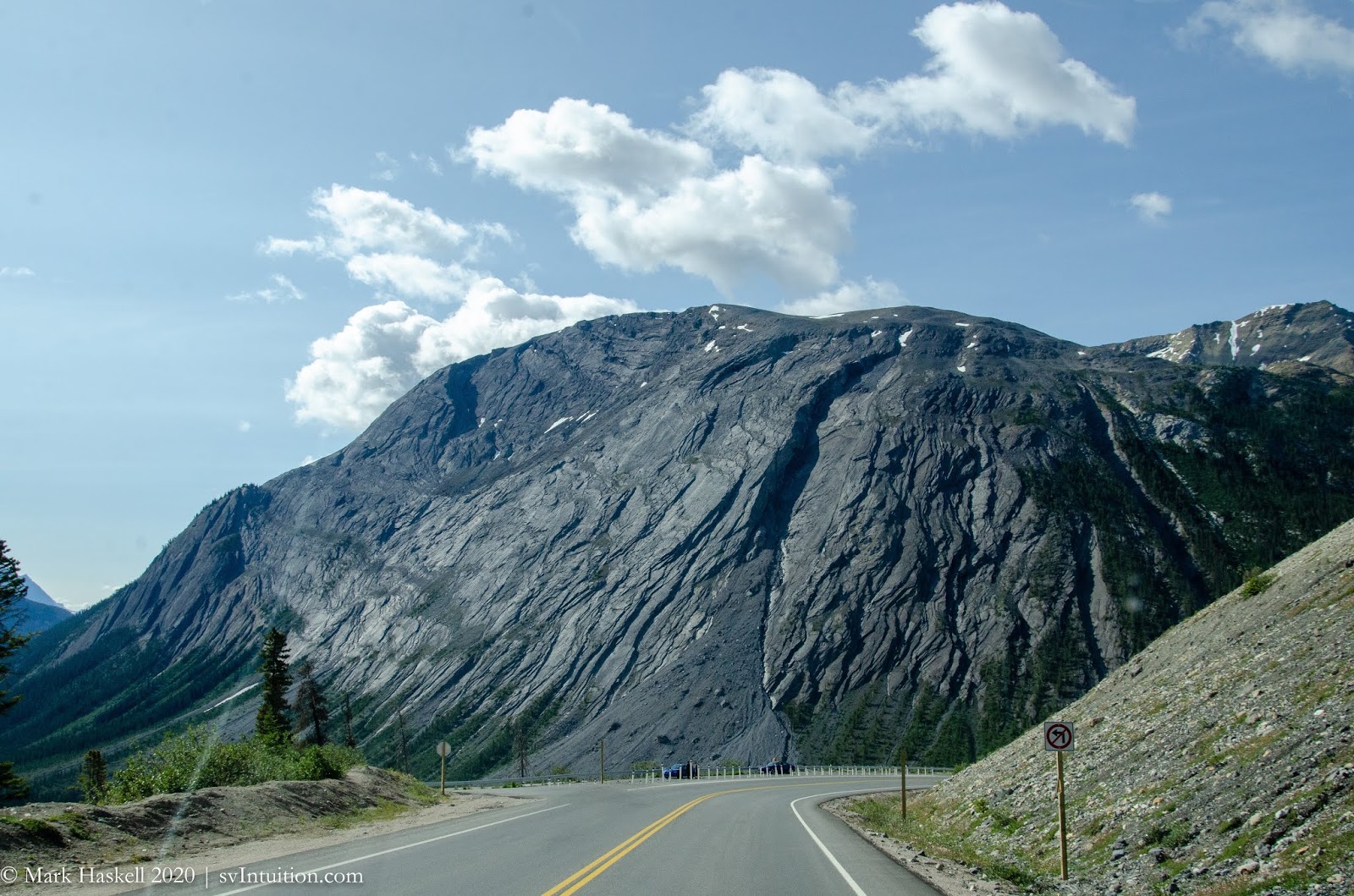

At our next stop we walked down to Mistaya Canyon where the rapids disappear into a thin slot canyon. I remarked that we should have put on hiking boots and brought our poles, and then we saw an older Amish woman from Ohio walking down the hill in flip-flops. I guess we are getting soft!

Rapids emerged from the canyon and raced towards Banff.

Mountains with jewel colored lakes lay on both sides of the parkway as we continued south.

Approaching Lake Louise we passed under earthen bridges designed to let animals safely cross over the road.

As we descended towards Lake Louise, rock mountainsides gave way to the green of pine trees.
At 1429, the road to Lake Louise was closed because the area had reached capacity. We stopped in the overflow parking lot and did some research. We could have spent the night in that parking lot, but it was crowded, sloped, and didn't have facilities.

By 1646 we were camped in a better overflow area in Tunnel Mountain Trailer Court near Banff. It wasn’t bad for $27.40. Not only did they have cell service, there were even clean showers without any additional charge. The only caveat here is that once you go in, you can't leave again that day. You might have trouble finding us as we were the smallest rig, by far, of the gathered campers.

Today's route down the beautiful Icefields Parkway.
No comments:
Post a Comment
We appreciate your comments! They will be published as soon as we get a chance to read them. Solicitations will not be published.